
By: Emma Wall 115311996.
The city of Paris is one that developed over time as political status became increasingly important and the drive for modernity took hold. The city began as a fishing port and flourished with industry as the society grew due to its location in the river seine. During the 1800’s the city developed at exponential rates, as can be seen in the maps below. Roads were improved along with the hygiene and sanitation of the city, with sewer systems being added as a means of making the city cleaner. Architecture changed from small streets and irregular buildings, to wide avenues with organised and symmetric buildings, giving the city a more uniformed and structured look.
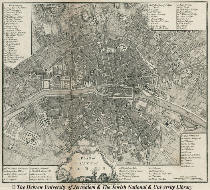
This map in figure 1 is from 1800. It demonstrates the changes that were occurring in Paris. At the time more emphasis was being placed on public spaces, which can be seen in the area marked as number 1 on the map, the Gardens of Lewis XV. This area will later become the Champs- Elysees, one of the most famous public streets in Paris. The area on the left side of the map is the site where the Arc de Triomphe would be built six years after the map was published. This map was created before the process of modernity was completed in the city and therefore the streets do not have a complete grid-like structure to them, they are still laid out in a somewhat random pattern.
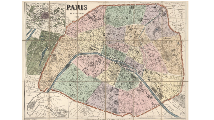
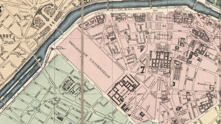
The map in figure 2 is from 1878 and it shows the progress of modernity on the city of Paris. The city has grown in size and the streets have become more uniform and structured, and the location of public spaces is more widespread. The Arc de Triomphe has been built at the top of the Champs-Elysees, which stretches all the way down to the Louvre Museum and the Palace of Versailles. The site where the Eiffel Tower will eventually be built can be seen in figure 3 below. At the time that this map was created to the third World Fair was being held on the same site. It was a way for the people of Paris to gather together and celebrate the national power and status of Paris.
Bibliography:
Princeton University (June, 2008). Exposition Universelle.
https://blogs.princeton.edu/rarebooks/2008/06/exposition-universelle-paris-1/comment-page-1/

Leave a comment